RESEARCH GROUP – PHYSICAL GEOGRAPHY & GEOMORPHOLOGY
Team:
 |
 |
 |
 |
|
| DEL MONTE Maurizio | DELLA SETA Marta | PIACENTINI Daniela | PICA Alessia | |
 |
 |
|||
| TROIANI Francesco | VERGARI Francesca |
Topics:
|
We analyse Earth surface processes and landforms with the principal aim of studying the geomorphological processes connected with tectonics and degradation, as well as the impact of human activities both in natural and urbanized environments.
|
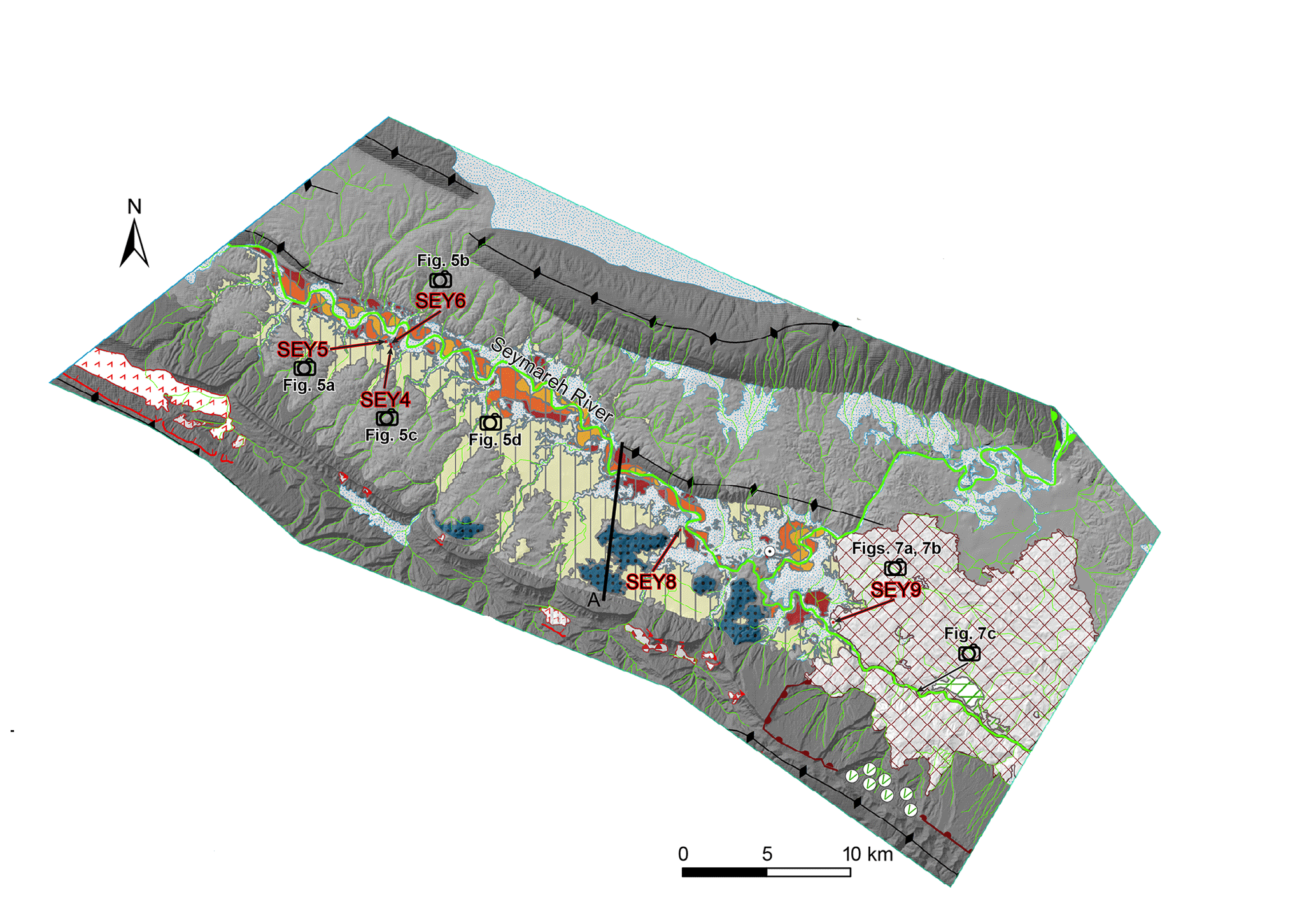 Geomorphological map of a sector of Zagros Mts., Iran (modified after Delchiaro et al., 2019, https://doi.org/10.5194/esurf-7-929-2019) |
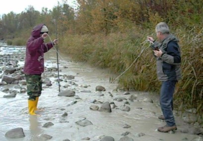 Fluvial monitoring |
We use field survey, geomorphological mapping, remote sensing techniques and terrain analysis. We plan and carry out monitoring of the effects of erosion processes at both catchment and hillslope scale; we develop numerical landscape evolution models, GIS-supported geomorphological, geomorphometric and hazard analyses in both natural and urban environments, also obtaining information on the response of geomorphological processes to climate change and active tectonics. |
|
We also study and implement strategies to exploit and enhance geodiversity and geomorphological heritage, also through multidisciplinary approaches. |
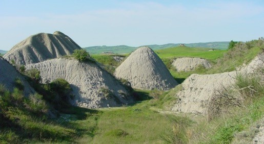 Biancane badlands in central Italy |
|
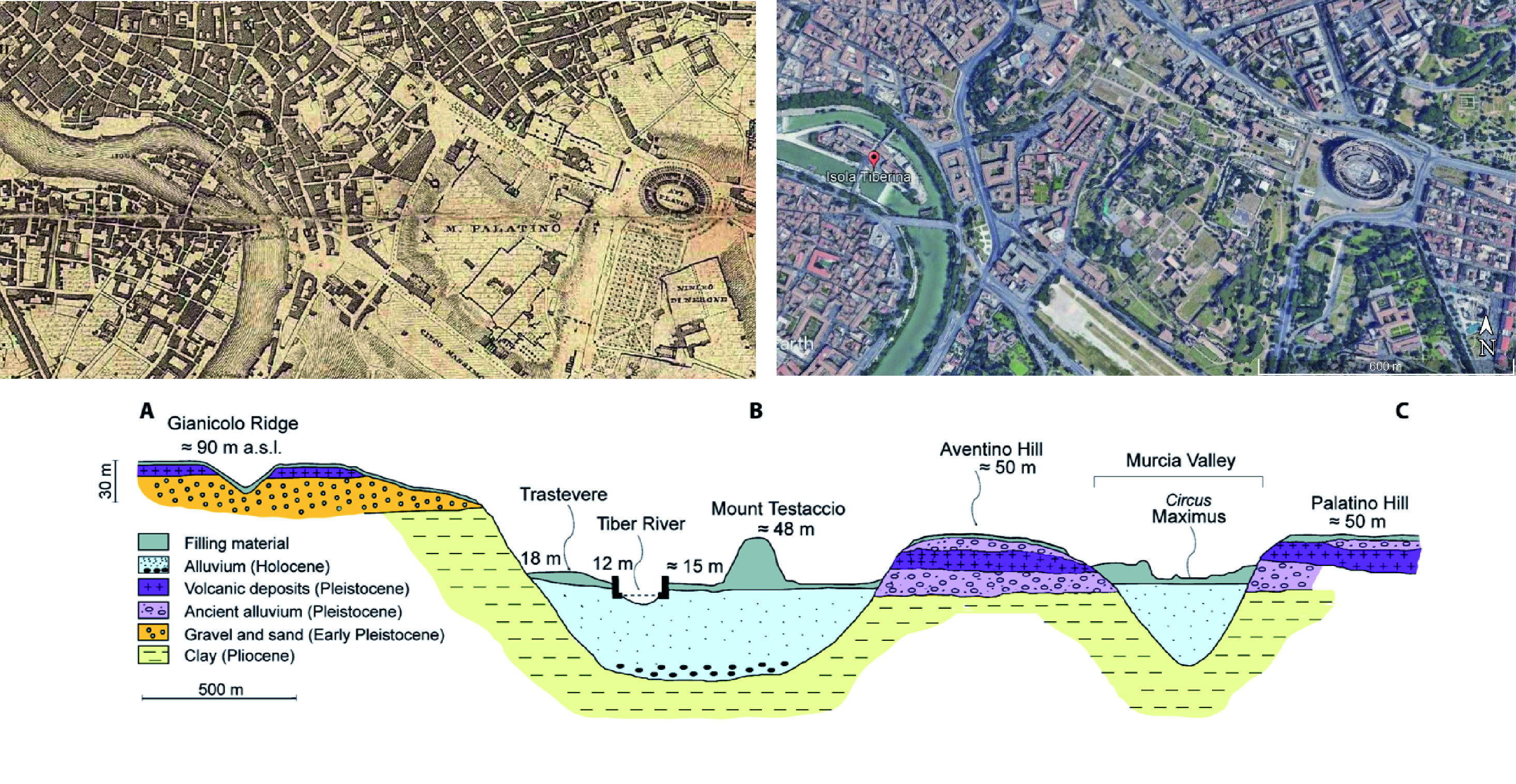
Multitemporal and multidisciplinary investigations in the urban landscape of Rome |
The research group's activity is evidenced by national and international awards and funding, numerous publications in high-impact international peer-reviewed scientific journals and communications at major international conferences. |
|
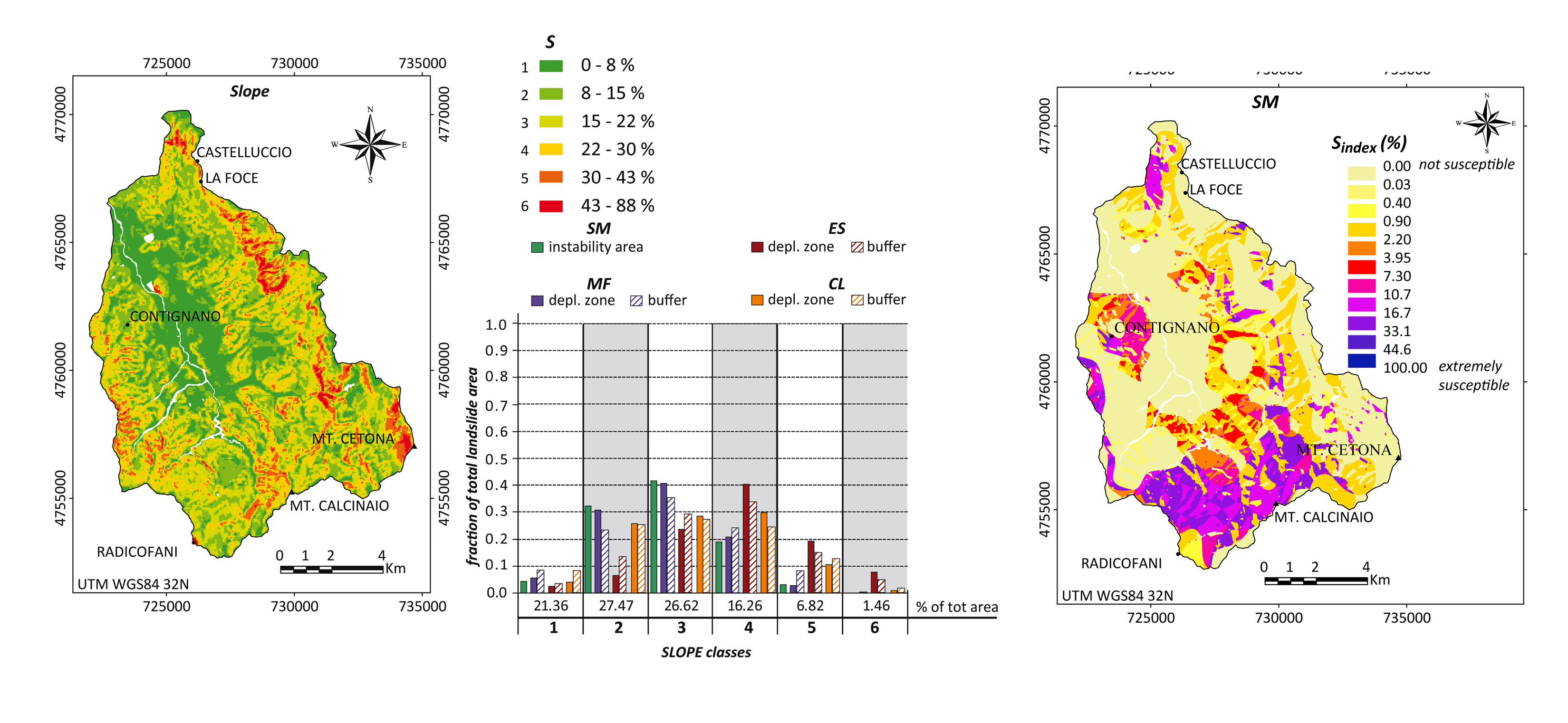
Landslide susceptibility analysis (modified after Vergari et al., 2011)
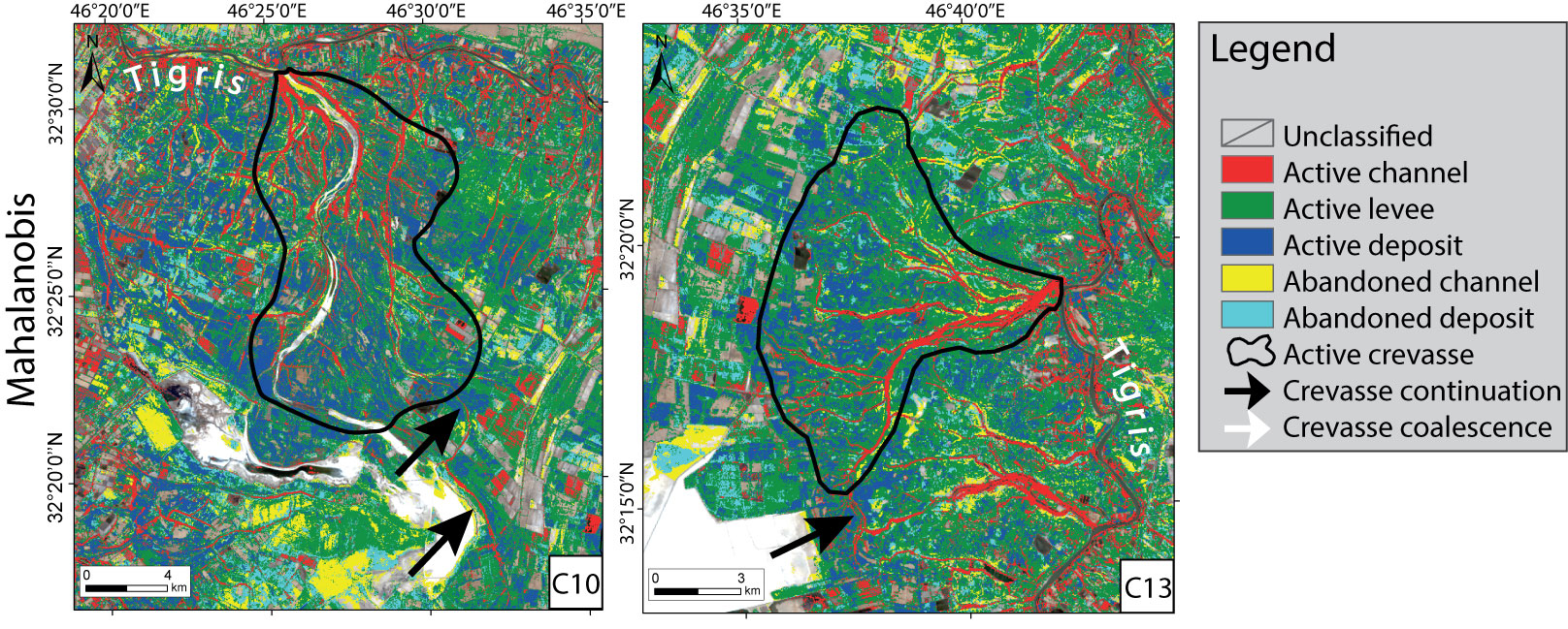
Classified active crevasse splay in a Satellite Multispectral Image (Landsat8) along Tigris River, Iran (modified after Iacobucci et al., 2020, Remote Sensing) |
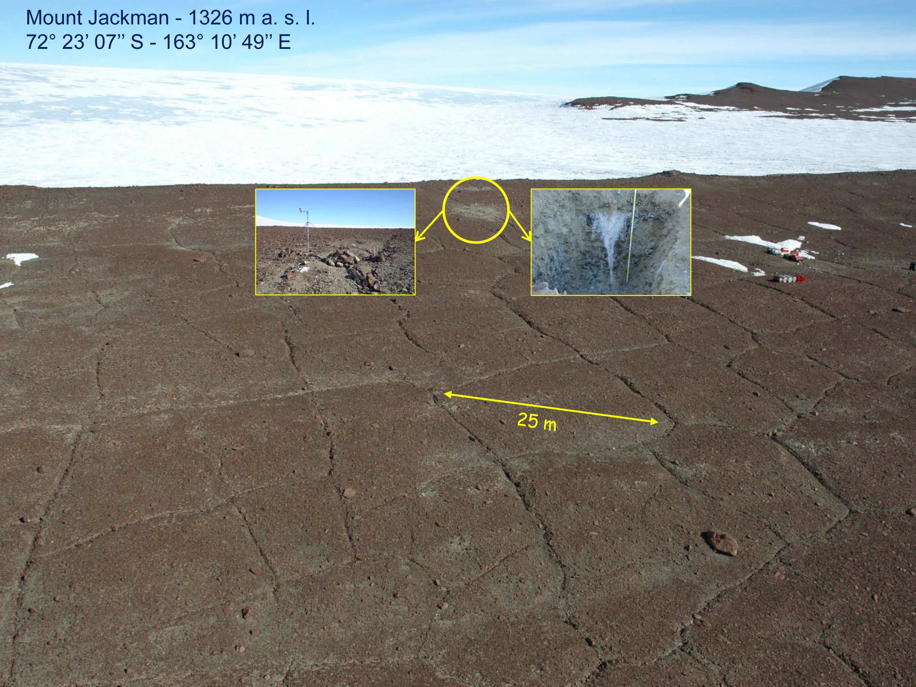 The ice-wedge polygon site of Mount Jackman is located in the upper sector of the Rennick Glacier in Northern Victoria Land, East Antarctica. Numerous sections were excavated across polygon troughs to a depth of about 1.5 m for sampling ice-wedge ice. In 2006, five sensors recording hourly temperatures of air and ice wedge at different depths were set up. |